Sunday, August 7, 2011

Wicklow Way Day 7 Shillelagh/Stranakelly to Clonegal

Day 7: Distance19km ascent 300m. Trail road and forestry track.
Wet muggy weather do you keep your wet gear on or take it off? I opt for combination of overtrousers on and jacket off-but Grainne is less optimistic.

Kissing the signpost shows that I was just happy to be close to Clonegal not the end of the Wicklow Way!

Noel & his daughter who not only 'shortened the road' for us on the final day but pushed our usual pace through the ceiling-thank you guys.

Ballinavortha House-a wonderful treat on our last night.


The only place to get a signal!-trying to direct Stephen en route to picking us up.


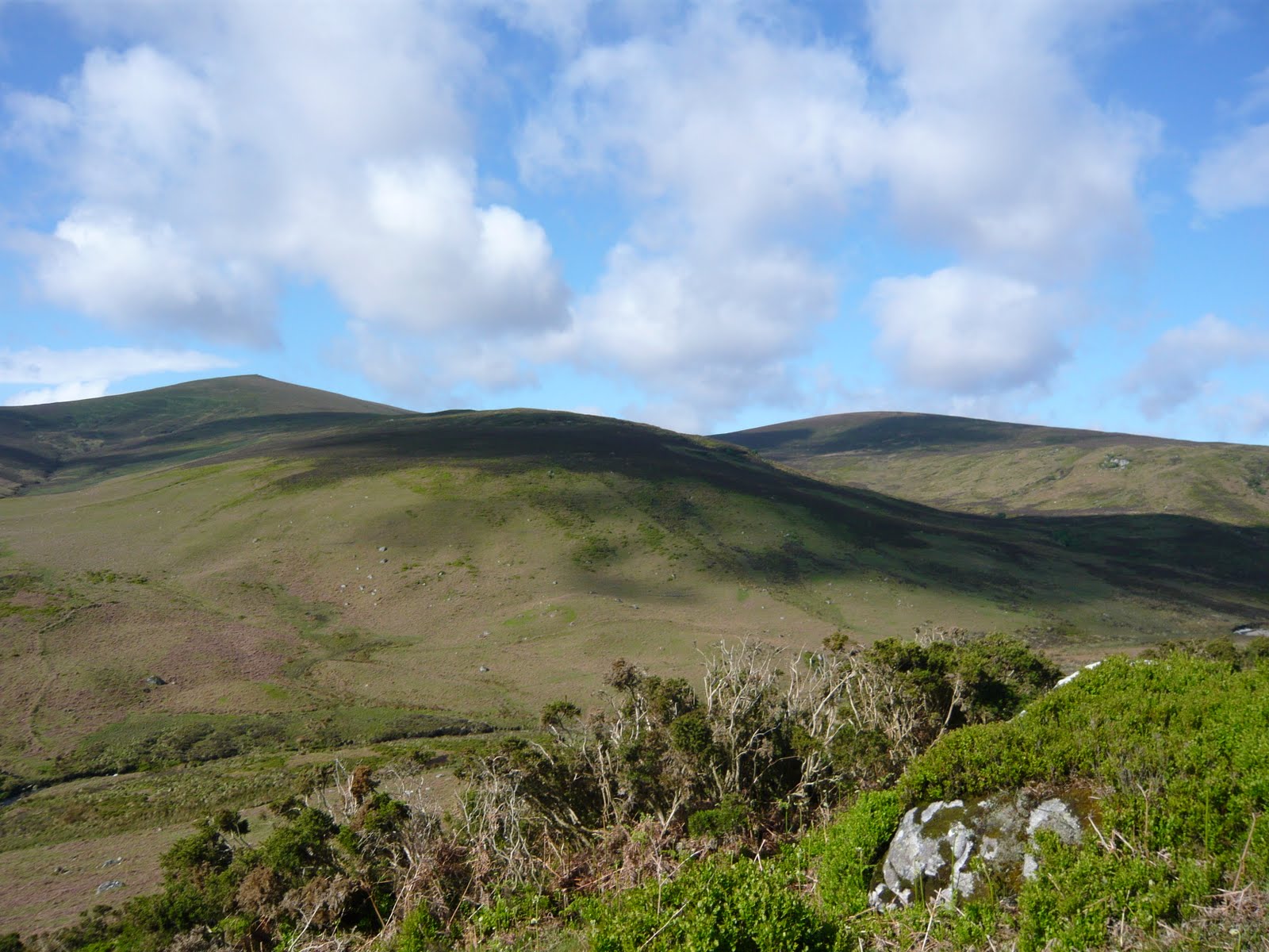
The WW seems to be a bit contrary today almost looping back on itself a couple of times for no reason. At Boley bridge we met up with a father and daughter at who had been walking the WW every weekend in a joint 'Get fit' project. It's obviously worked as they power along and we keep up with them talking all the way...phew! The signage continued to be good with just one tricky spot as you turn off down the shoulder of Aghowle upper and down to the left over a style- this is not clearly marked.  I know we walked past Raheenkit and up towards the top of Aghowle but just have a generic memory of coniferous plantations I think it was all the talking. Though I can proudly state that we, unlike other walkers we met today, walked up and around the forestry loop at Moylish/Newry rather than just sticking to the shorter road option (to be fair we just kept following the signs and chatting if I'd checked my map I would probably have opted for the shortcut to). It's road walking into  Clonegal. The village is small quiet and charming. We all head to the pub, not just for a well earned drink, but also as it's where we get our Wicklow Way certificates.It reminded me of getting my Compostela and FIsterrana after completing the Camino though in a more salubrious surrounding. The next couple of hours we just sat contentedly sipping our drinks and eating crisps until the owner of Ballinavortha B&B collected us. Ballinavortha is a beautiful period house which has been lovingly restored. It's also the same price as the hostels we've stayed in and therefore fantastic value. If you set off early and arrived at lunch time then it would be possible to get a bus back to Dublin but check Bus Eireann timetables as they are seasonal differences.

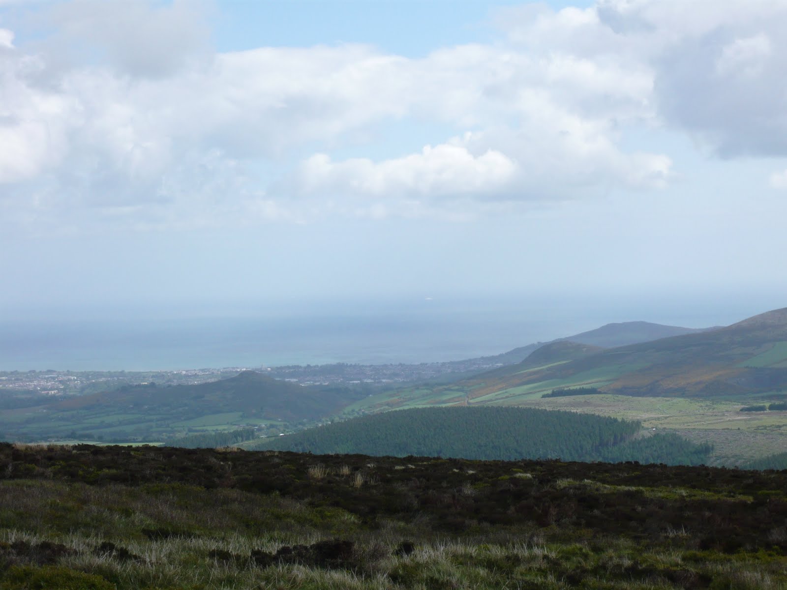
We loved walking the WIcklow Way .The scenery is beautiful even in bad weather. In the last three days we got to walk through a 'typical Irish landscape'. In fact this pastoral landscape is just as beautiful in it's own way as the more obviously spectacular scenery at the start of the walk and that of the other mountain routes that I generally walk. And I'm  very glad we got the chance to appreciate that alternative gentle landscape at walking pace. 
The Wicklow Way trail is very well signed and maintained and, with a little bit of planning, accommodation can be found to suit all budgets. In the first 6 days we met approx 12 other walkers most of them walking the route in the opposite direction i.e. back towards Dublin. This direction suits overseas visitors as they end up in the city and close to their flights home. On the final day we met a large group of walkers on an organised package walk there is an Irish company that does this as well as offering a luggage transport option.

It might come as a surprise to many walkers that there are only three pubs (Glendalough Arms, Glenmalure Arms and the Dying Cow at Stanakelly- and the latter could well be closed when you walk past)  and no shops or cafes en route (bar the visitor centre at Glendalough). So either pack all you need from the start or plan to divert at Roundwood and/or Laragh to restock on supplies.

We found www.wicklowway.com to be very useful in terms of planning daily sections and accommodation. But the guide book 'The Wicklow Way' by Jacquetta Megarry and Sandra Bardwell  one of the 'Rucksack Readers' was best in terms of route discription-it's also a handy sized, ring bound and waterproof see at http://www.rucsacs.com/books/Wicklow-Way/

Wicklow Way Day 6 Moyle to Stranakelly/Shillelagh

Day 6: Distance 21km ascent 500m. Trail small mostly forestry tracks and Drovers road (unpaved) with road walking at the end of the day.
Green tunnel down towards the Derry River nr Tinahely.


Nice days walking especially across shoulder of Ballincumber south on an old drovers road. The thought of a drink in The Dying Cow drove us on to Stranakelly crossroads only to find the pub closed! However we found there is a welcome porch with seating and the toilet is also left open. Plus friendly dogs. So we had a late picnic lunch there before pressing on to our accommodation at Lugnaquilla view B&B. Anne and her husband are most welcoming and they provided us with ridiculous amounts of food and drink as we watched the Eurovision song contest (actually perfect mindless watching for the knackered walker). In addition Anne stokes up the roaring fire in the sitting room like a very demon-so no matter how cold and wet you are you'll dry out pretty quickly! Clean comfy welcoming and great value for money. I think they also allow camping in their large back garden and its a very handy stop off point the only other alternative is going about 3km off route to Shillelagh.

Wicklow Way Day 5 Glenmalure to Moyle.

Day 5: Distance 21km ascent 550m. Trail at the start stoney paths & forestry tracks with quite a bit of road walking at the end of the day (bit hard on the feet)
Sunny panorama looking towards Mt Leinster- after hours of mud and rain slogging it out of Glenmalure, up Slieve Maan, Carrickashane and over to Sheilstown (note Grainne still in her rain gear as we'd been fooled before!)

This is the only photo we took as the weather was foul and we just couldn't face unwrapping the camera from its layers of plastic. I found this the most challenging day with long muddy slogs up through corridors of conifers in rain and fog. It seemed interminable and when the sun eventually came out we had a long road walk to Moyle (no shops) and then a stiff uphill road walk to our accommodation at Kyle farmhouse. The farm is located on the northern slope of Ballycumber and the owners  are farmers and keen walkers who've both done the WW in 3 days. So don't expect any sympathy if you complain! Hearty dinner and a glass of wine put us to rights in no time.
Personally this is a section I wouldn't walk again soon and would choose instead to explore Glenmalure further. Though if we'd had better weather my opinion would probably be completely different. We certainly saw lots of deer and hares today.
The landscape changes to green pastoral lushness in this section-a bit of a shock from the rugged terrain of the last few days. But despite the 'tameness' of the landscape there are no shops or pubs en route so if you're camping you'd need to pack food for your dinner. The range of accommodation is limited to one place really unless you want to stay off the WW in Aughrim, Tinehealy or Shillelagh but these are quite distant and you'd need to organise transport.

Wicklow Way Day 4 Glendalough to Glenmalure

Day 4: Distance12km ascent of 350m practically all on track, paths with one short boardwalk section.
Once off the roads this brown sign is replace by the little yellow hiker or a yellow arrow.

On the saddle between  Lugduff & Mullacor, looking up towards the head of Glenmalure.


On the boardwalk looking back at Lugduff before the walk down shoulder of Mullacor
Looking down into middle of Glenmalure

Grassy path across shoulder of Mullacor before steep left turn down to the top of stone steps.
The steps heading down to the gravel track with great view of upper Glenmalure.

The Mullacor hut-up steep bank on left so need to key an eye out for it. Great place to stay about 2km from pub but its uphill on the way back!

Monastic sites, waterfalls, expansive views great walking! We stayed one night at the Mullacor hut-which is well set up and cosy- as we wanted a day to explore the wilds of Glenmalure and then one night in the Glenmalure Arms a great pub/B&B providing fantastic value for money. Hot toddy on arrival, great dinner, comfy beds, brilliant breakfast and packed lunch if desired (we'd brought our own supplies). If camping but find the hut is a bit too basic (i.e. too far from the pub) then there is a campsite just over the road from the pub which is run by the owners of the Glenmalure Arms.

Saturday, August 6, 2011

Wicklow Way Day 3 Oldcastle to Glendalough

Day 3: Distance 12km ascent 350m. Trail track, path, with very small sections of road (unless diverting to Laragh to get supplies then additional 1km approx of road) 
 It's great to get some fresh water provided by the side of the track.


Be sure to replenish your water here as none at the hut

Brusher Gap Hut is maintained by Mountain Metheal and they do a great job. Fire pit, sleeping platform and enough shelter for an overnight(good option for night 2 camping place).

Updating journal at Brusher Gate Hut

Starting from where we left off yesterday two short sections of road rest on track. Passing Brusher Gap mountain hut on the right (this would be good place to camp on night 2) When coming off Paddock hill and down towards Laragh and if camping and/or running out of supplies then make a small diversion to Lagagh village as it's the last opportunity to shop for 3 or 4 days. 
We cross the Glenmacnas river - magical wooded section that tempted me to go for a dip.  The signage continues to be well positioned and clear.  At the end of the day the WW brings you slap up against the Glendalough Arms. This is the hotel my parents stayed in on their honeymoon! We stayed at the Glendalough International Hostal but as this is expensive enough I'd explore B&B options if doing it again. We waited until evening to visit the monastic site so had it pretty much to ourselves-lovely. In the process we 'knocked off' the very first part of the next days walk so we wouldn't have to backtrack when we left the hostal the next morning.

Wicklow Way Day 2. Knockree to Oldbridge

Day 2: Distance 18km ascent 500m. Trail mostly track and path with 2 very short road sections (unless staying in Roundwood then additional 2-3km of road walking).
                                          Looking back to Knockree from Crone wood


Though Day 2 is only 18km long  Grainne found this the most demanding day physically. It has 4 small sections of road walking but the majority of the day you're walking on sheep paths and tracks some of which are quite remote. If walking this stage at the weekend you are likely to meet other walkers as the all the walks through Crone wood, and on up to Maulin and Djouce mountains, are popular day walks for Dubliners. However if walking off season and/or midweek one might not meet anyone at all-so it would make sense to notify someone of your plans and timeframes.

                                      Looking down to Powercourt Waterfall from Riders Rock


The terrain is 'off road' with some stiff climbs up but, unless you decide to detour to the top of Djouce instead of walking around it's shoulder, the rounded top of White hill is the only summit you'll cross. There are sections of boardwalk across the boggy tops these must be great in very wet weather but are a little narrow if using poles and are also a little bit pitted in places so you could trip. The BW are there to protect the bog but after a while I preferred to walk beside the BW on the drier downhill sections. The only issue with this section was that-after the road walk above Lough Tay when you turn right off the road into a section of forestry- we found timber was being felled and the workers had changed/removed some of the signs and provided some paltry markings for an 'alternative' route. This is probably just a temporary measure but as you can see Roundwood village below you it's easy enough to figure out the route down yourself. 
 The are plenty of scenic 'wow' moments today especially if you get a break in the weather. But the views down onto Powerscourt Waterfall and down onto Lough Tay are definitely amongst the best. 


             Steep descent down to beautiful Glensoulan, but 'who climbs down must climb up!'


If you were camping, and you were fit enough to tackle an additional climb on your first day, then this would be a remote and lovely place to camp (it's within the National Park where camping is forbidden so I'd be discrete and walk upsteam off the track to keep 'off their radar').


War hill in foreground Djouce(L) and Tonduff South (R) in the background.

From the shoulder of Djouce looking out over the  Dublin/Wicklow Coastline

Blown away by the view! Looking across to Luggala from Boardwalk Whites Hill 

Grainne at the JB Malone Memorial with Lough Tay below us.

We opted to stay at The Skylarks rest in Roundwood an independent hostel that provides breakfast. It's 2km off the WW. Having planned to meet up with a friend who wanted to walk with us for the last 10km we were really looking forward, in addition to the joy of her company of course, the prospect of getting lift from her husband to the hostel! However she didn't turn up so  we had an extra trudge to the hostel. No matter how long or short the day the last 4 km always kill me so I was dragging my heals a bit at this point. Roundwood has a good variety of places to eat or shops to buy supplies and it's only short stroll from the hostel. If you were taking the camping option I'd push on for a kilometer or so beyond Oldbridge to overnight at the mountain hut at Brusher gap as an option for night 2 and I'll do that the next time.
We heard coo coos calling, saw deer, hares and lots of skylarks. Overall a superb days walking... despite the weather.


Wicklow Way Day 1.Marley Park to Knockree

Overall distance 132 km & ascent 3,200m

Day 1: Distance 21km ascent 600m.Trail made up of park paths small section of public road but mostly on track.
                                  Grainne striding along the Wicklow Way day 1


Looking at down into Glencree. Typical WW signage on right. 


Though I always knew I'd do it one day the Wicklow Way wasn't on the top ten of my walking list at all. The raison d'etre for this walk was Grainne's determination to knock it off her 'Bucket list' As she was a complete novice she wanted someone to go with her and though I  can't quite remember doing it I must have said "yes" at some stage.
                                         'Just when did I agree to this?'


We started on Monday the 9th at the official starting point in Marley park Dublin. As I'm unfit and Grainne is fit but new to the game we took 7 days to walk to the route to it's official end at Clonegal. The trail could be walked in a vigorous 5 days or a 'Germanic' 3 but we took the 'doucement' approach. The Wicklow Way is very well signed throughout it's length with only one unclear turning on the 4th day. At the start there is an overlapping of the route with the Dublin Mountain Way and, as the graphic for both walks is a little yellow hiker, you have to be a little careful on day 1 to check which initials (WW or DMW) appears below the schematic. The path and markings are  maintained and repaired in fine order by the voluntary group Mountain Meitheal. In fact we found we could, barring seriously bad weather, have walked the whole way without using map or guide if we had wished (we  had maps and a compass in case of course- as should anyone walking the WW)We used Ordnance Survey of Ireland Discovery Series maps scale 1:50 000 numbers 56 and 62-didn't need no 63 as it only covers the last well signed few km of the route into Clonegal) The weather was pretty wet windy and blustery with occasional welcome 'breaks' in the weather. 
After a short stroll through the park (literally) it's pretty much straight up and over to Glencullen with another up and over down to Glencree and a short climb through Cuttlestown wood to Knockree. If you were camping Cuttlestown wood might be a good spot as camping by the Glencree river is policed due to littering caused by some parties of kids coming out from the city to 'party'
We stayed at the Youth Hostel which practically on the Way and it does have cooking facilities. The hostel is great and has coffee and tea facilities 24/7 and the staff were really warm and helpful. I'd advise against taking a taxi into Enniskerry (a steep 15 euro each way for a 5km journey) as we did and would cook up at the hostel. The rooms available for smaller parties are very comfortable with showers en suite. The hostel is seasonal and opens in April to September. We 'knocked off the 1st part of the next days route by walking the 'dog leg' down and along by the Glencree River.This is a lovely section and we enjoyed the (rare) evening sunlight after dinner. It also allowed us to head 'straight down' the hill from the hostel the next morning and avoid backtracking
This is a memorable start to the walk and gives you enough of a 'workout' to prepare you for the next three days.